Phantom 4 Pro Ppk
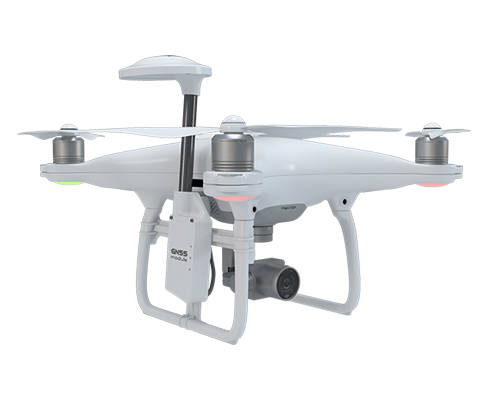
Get a new DJI Phantom 4 Adv/ProV1/ProV2 with geodetic GNSS receiver, ready for high precision surveying
Why Phantom 4 PPK?
The Benefits

GNSS Receiver

Module Design

Support

Accurate Shutter Sync

Calibrated Camera

Survey and Data Processing Manual
How it works
The geodetic GNSS receiver records satellite observations. The time of each shutter moment is accurately captured. After the flight, GNSS data is processed together with the data from the base station. Obtained exact coordinates of the of image centers are used for photogrammetric processing and stitching an orthomosaic with 3-5 cm accuracy.
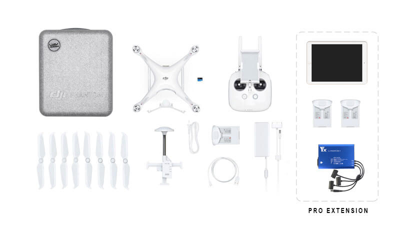
In the Box

The cost of "Pro extension" is 830 €
Price
P4 Advanced
In stock!
P4 Professional V1
Preorder.
P4 Professional V2
Preorder.
Advanced and Pro drones are completely identical, except for Pro’s side collision sensors, which are not used during aerial survey. Differences in prices are only due to the difference in the dealers cost.
Tech Specs
Coverage per flight
2 cm/pix – 30 Ha
3 cm/pix – 40 Ha
4 cm/pix – 50 Ha
Data quality
Horizontal accuracy 5cm
Vertical accuracy 7cm
GSD up to 2cm/pix
Flight capabilities
10 m/s wind tolerance
-10 to +40 °C temperature range
Up to 500m flight altitude
Up to 30min flight time
Camera
1″ CMOS sensor
20 megapixels
Mechanical shutter
GNSS receiver
Survey grade GNSS receiver
GPS/QZSS L1, GLONASS G1, BeiDou B1, Galileo E1, SBAS
PPK processing support
Precise shutter sync
Flight Planning App
Automatic flight
iPhone support
Android support

